
Guide every visitor.
Straight to the door.
From their own phone.

For hospitals, stations, airports and venues - blue-dot indoor positioning and turn-by-turn wayfinding, embedded directly in your own mobile app. No app to download, no hardware for visitors to carry.


Built on ISO 27001 Cisco HPE Aruba
You are here · Level 0
Arriving at Cardiology
Definition

What is indoor navigation & wayfinding?

Canonical definition

Indoor navigation is real-time, blue-dot positioning and turn-by-turn guidance inside a building, delivered through a smartphone. It shows visitors where they are on an indoor map and routes them step by step to their destination across floors and buildings. Pole Star embeds this directly into your own mobile app - no separate app, no hardware for the visitor.

What

It gives visitors a blue dot and a guided route indoors, right inside the app they already use.

Who

It serves patients, passengers, visitors and staff in hospitals, stations, airports and venues.

Why now

People get lost in complex buildings, and confusion costs missed appointments, delays and stress.

How

Pole Star's NAO® Mobile SDK turns a phone into an accurate, multi-floor indoor guide inside your app.

Three things Pole Star delivers on the phone

Blue-dot positioning

Visitors see their own live position on an indoor map, accurate to the room and the floor.

Turn-by-turn wayfinding

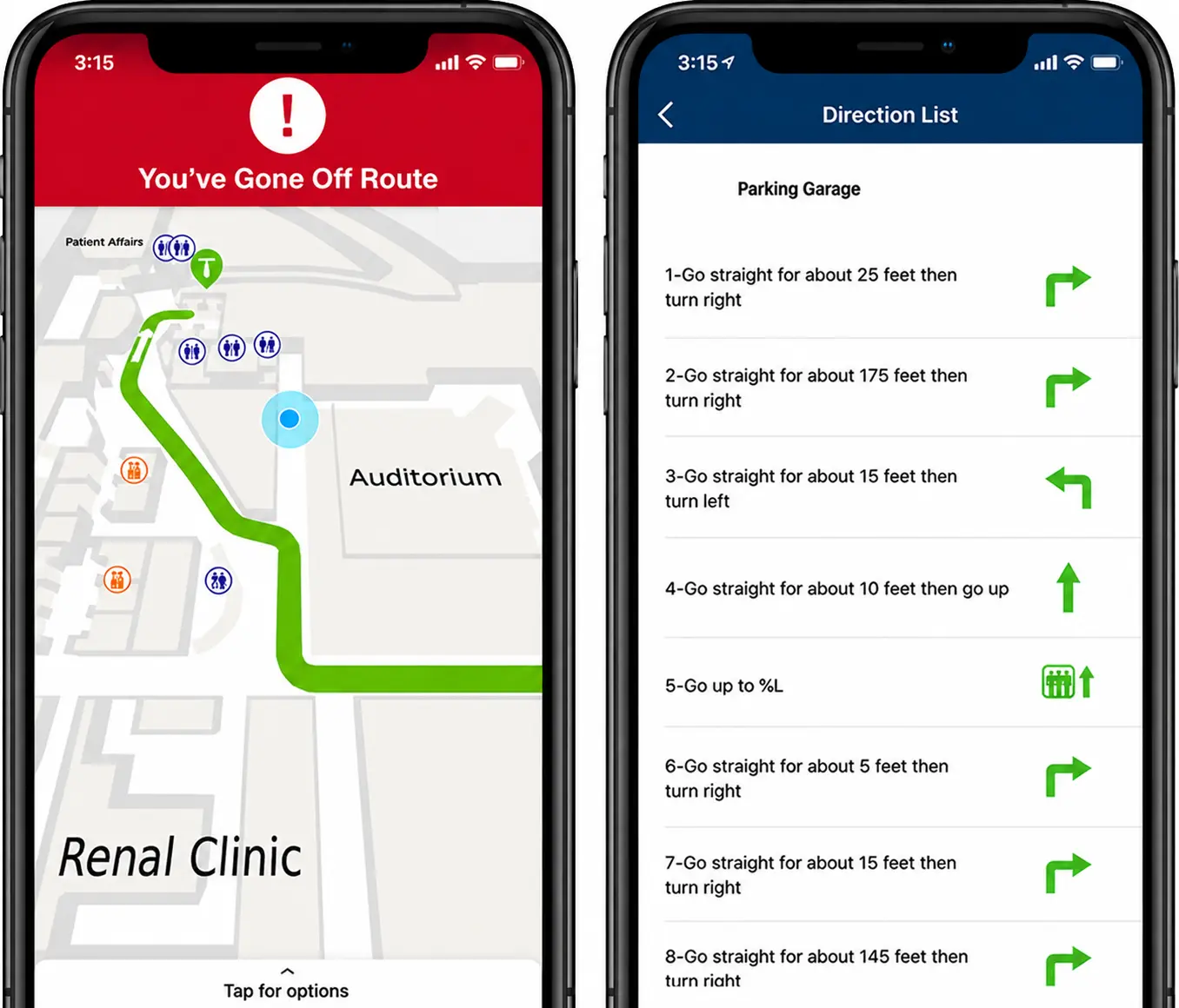
Step-by-step routes across floors and buildings, with off-route detection and rerouting.

Inside your own app

Embedded with the NAO® Mobile SDK - no separate download, no hardware for the visitor.


The business challenge: complex buildings, lost visitors

Hospitals, stations and large venues grow over decades into complex, multi-floor mazes. Visitors arrive under stress and time pressure, and signage alone can't keep up with buildings that change constantly.

The result is friction that costs real money: people arrive late or miss appointments, staff are pulled away from their work to give directions, and first-time or reduced-mobility visitors carry the heaviest burden. Getting lost is a location problem before it is an experience problem.

Static maps and kiosks don't move with the visitor. What people expect now is the same thing they get outdoors - a blue dot and a route, on the phone already in their hand.

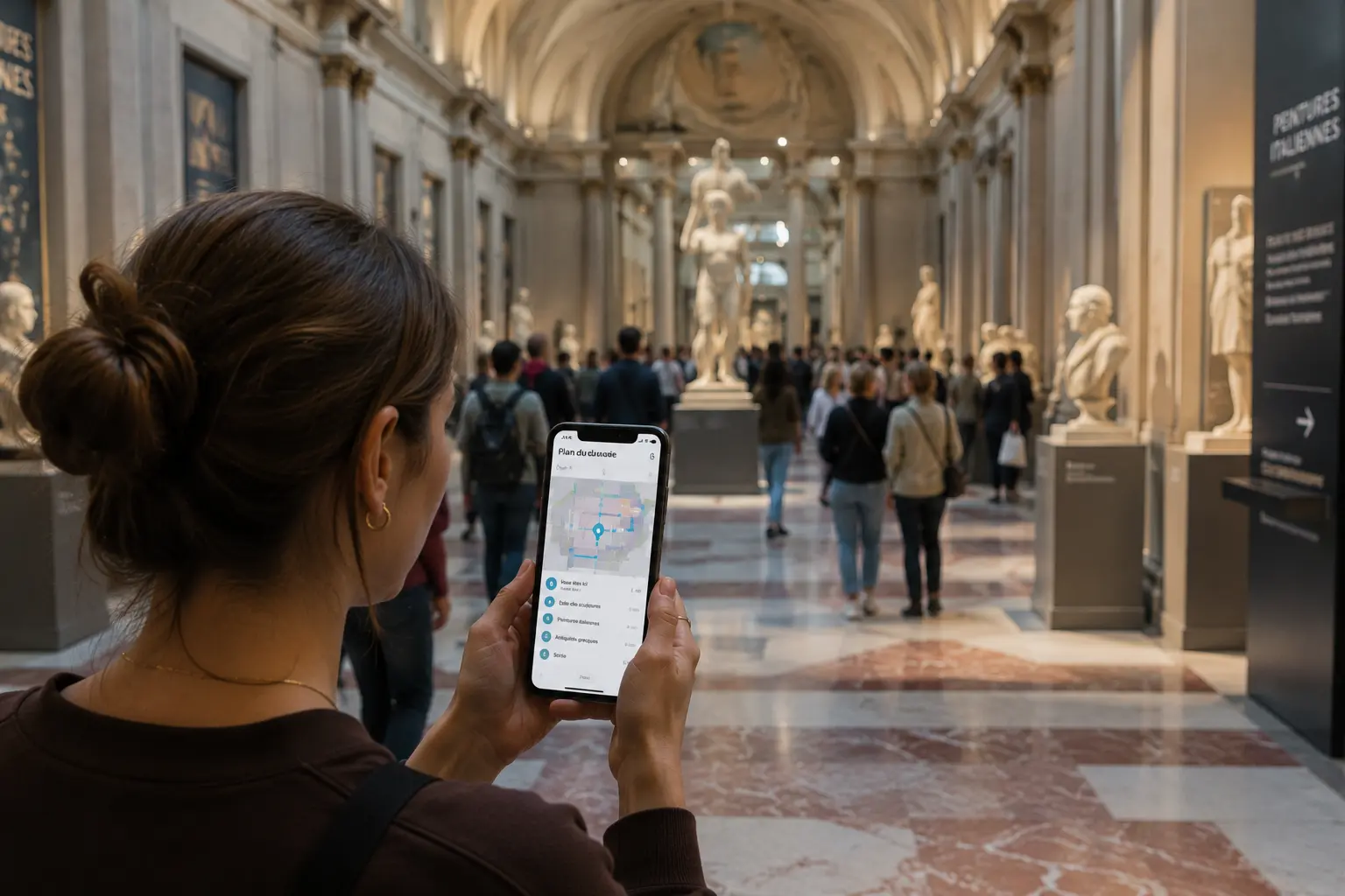
A visitor navigating a large facility

The cost of getting lost - healthcare, the most-documented case

30%
Of first-time hospital visitors get lost, and over 85% ask staff for directions.
Source: Gozio / Mappedin
4,500h
Staff hours a year spent giving directions at one hospital - over two full-time roles.
Source: Emory / Zimring
~30%
Of patients' total care time is spent traveling - about 38 minutes per visit.
Source: GBBN
25%
Reduction in missed appointments reported by hospitals using digital wayfinding.
Source: Gozio
Questions buyers ask
How do you stop patients getting lost in hospitals?
What is indoor wayfinding and how does it work?
Can indoor navigation go inside our own app?
Does it support accessible routes for reduced mobility?
Business outcomes

What changes when visitors can find their way

Concrete outcomes operations and patient-experience teams see with indoor wayfinding in their app.

01

Fewer late & missed appointments

Visitors arrive on time when they can follow a route straight to the right room.

02

Calmer, more confident visitors

Self-guided navigation removes the stress of getting lost in an unfamiliar building.

03

Staff freed from directions

Fewer people stopping to ask the way gives front-line teams their time back.

04

Accessible for everyone

Routes adapted for reduced mobility make the building easier for all visitors.

05

More value from your app

Wayfinding gives people a real reason to open and keep your mobile app.

06

Smoother arrivals

Arrival notifications to staff help coordination and keep schedules on track.

Common pain points

Sound familiar?

What teams hear before they put real indoor navigation in their app.

Patients keep arriving late because they can't find the right department.

Late arrivals push schedules back and disrupt everyone's day.

Our staff spend half their day pointing people down corridors.

Time spent giving directions is time taken away from real work.

We've added more signs, but people still get lost.

Static signage can't keep up with buildings that change constantly.

Visitors with reduced mobility have no idea which route works for them.

Without accessible routing, some visitors are effectively left behind.

We don't want to make people download yet another app.

A separate app means low adoption and a fragmented experience.

Outdoor maps stop working the moment people walk inside.

GPS fails indoors, exactly where large buildings are hardest to navigate.

How Pole Star solves it

From an open app to a guided arrival

1

Your app + NAO Mobile SDK

Embedded

Wayfinding runs inside your own mobile app - nothing extra for the visitor to install.

2

Blue-dot positioning

BLE / Wi-Fi

The phone senses beacons and access points to place the visitor accurately on the indoor map.

3

Map & routing engine

Multi-floor

Pole Star computes the best route across floors and buildings, including accessible options.

4

Turn-by-turn guidance

Rerouting

Step-by-step directions guide the visitor, with a nudge if they drift off the path.

5

Arrival & notifications

Coordination

Staff can be notified on arrival, helping punctuality and appointment coordination.

6

Better experience

Outcome

Less stress, fewer missed appointments and a smoother journey for every visitor.

In practice

A patient opens the hospital's app on the way in, searches for their appointment, and sees a blue dot on the indoor map. A route guides them across floors, straight to Cardiology - reroutes if they take a wrong turn, and lets the department know they've arrived. No signs to decipher, no one to ask.

How the technology works

The phone finds itself, then draws the route

No hardware for the visitor - the NAO Mobile SDK inside your app senses the BLE beacons and Wi-Fi around the phone, computes a blue-dot position, and routes the visitor turn by turn across floors.

BEACON WI-FI AP BEACON BEACON YOUR POSITION Blue dot
your app · route
Guiding to
Cardiology · Level 2
1

Phone senses signals

The SDK reads BLE beacons and Wi-Fi around the phone.

2

Blue dot computed

Pole Star places the visitor on the indoor map.

3

Route across floors

The engine builds the best multi-floor route.

4

Turn-by-turn in your app

Step-by-step guidance to the destination.

Inside your own app - no visitor hardware
App search and indoor map

Search & locate

Visitors search a destination and instantly see where they are on the indoor map.
NAO MobileBlue dotSearch
App turn-by-turn route

Guided & accessible routes

Turn-by-turn directions across floors, with routes adapted for reduced mobility.

Turn-by-turnMulti-floorAccessible
Key features

Everything a visitor needs to find their way

Built around what visitors expect and what teams get asked for.

Blue-dot positioning

Real-time position on the indoor map, accurate to the room and the correct floor.

Visitors always know where they are.

Turn-by-turn routing

Step-by-step guidance across floors and buildings, with rerouting if a visitor drifts off path.

No signs to decipher.

Accessible routes

Routes adapted for reduced mobility, favouring lifts and step-free paths.

The building works for everyone.

Off-route notifications

A gentle nudge when a visitor deviates, so they get back on track before getting lost.

Fewer wrong turns, fewer delays.

Arrival notifications

Staff can be notified automatically when a visitor arrives at their destination.

Better coordination and punctuality.

Embedded in your app

Delivered with the NAO Mobile SDK, so wayfinding lives inside your existing app.

No second app, higher adoption.

Typical use cases

What visitors solve with indoor wayfinding

Find your appointment on time

Trigger

A patient arrives for an appointment in a large hospital.

Action

The app routes them from the entrance to the right room.

Result

They arrive on time, without asking for directions.

Healthcare

Catch your train from concourse to platform

Trigger

A traveler needs to reach a platform in a busy station.

Action

The app guides them across levels to the right platform.

Result

Less stress and fewer missed connections.

Rail & metro

Navigate step-free with reduced mobility

Trigger

A visitor needs a route without stairs.

Action

The app builds an accessible route favouring lifts.

Result

An independent, dignified journey.

Accessibility

Let staff know a patient has arrived

Trigger

A patient reaches their department.

Action

An arrival notification is sent to staff.

Result

Better coordination and punctuality.

Healthcare

Find a gate, lounge or service in a terminal

Trigger

A passenger looks for a gate or amenity.

Action

Search and route guide them straight there.

Result

Smoother flow through the building.

Airports

Get back on track after a wrong turn

Trigger

A visitor drifts off the planned route.

Action

An off-route notification reroutes them instantly.

Result

They reach the destination without getting lost.

Wayfinding
Industry applications

Where indoor wayfinding matters most

The environments where finding your way makes the biggest difference.

Healthcare wayfinding

Healthcare

Patients and visitors navigate complex, multi-building hospitals from their own app - with accessible routes and arrival notifications that reduce missed appointments and stress.

Deployed across a 60+ hospital network
Healthcare solutions

Rail & transport

Travelers self-locate and follow precise indoor routes between entrances, platforms and services in large, multi-level stations - embedded in the official passenger app.

Deployed with SNCF, in the "Ma Gare" app
Rail & transport solutions
Also applied in
Customer stories

Indoor wayfinding, proven at scale

Hospital network Healthcare
60+ hospitalsMulti-buildingIn-app
Challenge

Help thousands of patients and visitors navigate complex, multi-floor hospitals every day - often under stress and time pressure.

Solution

Indoor wayfinding embedded in hospital mobile apps with NAO Mobile - accessible routing, off-route and arrival notifications, interfacing with hospital information systems.

Results
  • 2% reduction in missed appointments across the network
  • Estimated $300k-$600k in additional revenue
  • Improved patient experience and reduced stress for patients, visitors and staff

Read full case study
SNCF station Rail & transport
Major stationsMulti-level"Ma Gare" app
Challenge

Help thousands of travelers orient themselves and find their way through large, multi-level railway stations, reducing confusion and delays.

Solution

Indoor localization and wayfinding embedded in the official passenger app, with the NAO Mobile SDK and NAO BlueSpot V4 Rugged for demanding, high-traffic stations.

Results
  • Travelers self-locate and follow precise indoor routes across levels
  • Smoother movement between entrances, platforms and services
  • Improved passenger experience with less stress and fewer delays
Read full case study
Why Pole Star

Pole Star vs static signage vs outdoor map apps

Criterion
Pole Star
Static signage
Outdoor map apps
Live indoor position
Blue dot, room-level
None
Fails indoors
Multi-floor routing
Across floors & buildings
Fixed points
No
Turn-by-turn & rerouting
Dynamic
No
Outdoor only
Accessible routes
Reduced-mobility aware
Limited
No
Delivery
Inside your own app
Physical install
Separate app
Keeping maps current
Update digitally
Reprint & remount
No indoor maps
01

Real indoor accuracy

Blue-dot positioning to the room and floor, where GPS and signage both fall short.

02

Inside the app people already use

Embedded with the NAO Mobile SDK - no second app to download, so adoption is high.

03

Proven across hospitals and stations

Deployed across a 60+ hospital network and in major railway stations.

FAQ

Indoor navigation, answered

How it works · technical
How does indoor navigation work on a smartphone?

The NAO Mobile SDK inside your app senses the BLE beacons and Wi-Fi around the phone and computes a blue-dot position on the indoor map. From there it builds a turn-by-turn route to the destination - no hardware for the visitor to carry.

How accurate is blue-dot indoor positioning?

Pole Star delivers room-level accuracy, on the order of 1-5 meters, including the correct floor. That is precise enough to guide a visitor to a specific department, gate or platform.

Does it work across multiple floors and buildings?

Yes. Routes span floors and buildings, guiding visitors via lifts, stairs or escalators as needed - proven across large multi-building hospitals and multi-level stations.

What happens when GPS doesn't work indoors?

That is exactly the gap Pole Star fills. GPS fades inside large buildings, so Pole Star uses BLE and Wi-Fi to keep an accurate blue dot where outdoor map apps stop working.

Does it support accessible routes for reduced mobility?

Yes. Routes can be adapted for reduced mobility, favouring lifts and step-free paths, so the building is easier to navigate for every visitor.

What are off-route and arrival notifications?

If a visitor drifts off the planned path, the app nudges them and reroutes. On arrival, staff can be notified automatically, which helps coordination and appointment punctuality.

Does positioning drain the phone battery?

The SDK is designed for efficient use of BLE and Wi-Fi sensing, so navigation runs with modest battery impact, comparable to other map or location features on a phone.

Deployment & infrastructure
Can indoor navigation go inside our own mobile app?

Yes - that is the core of the approach. The NAO Mobile SDK embeds wayfinding directly into your existing app, so visitors use the app they already have rather than downloading a separate one.

Does it need beacons, or does Wi-Fi work?

Pole Star uses BLE beacons and Wi-Fi together. Existing BLE-enabled Wi-Fi can be used, with beacons added where extra precision is needed - the mix depends on the building.

Does it work with Cisco or HPE Aruba?

Yes. Pole Star works with existing Cisco and HPE Aruba infrastructure, which keeps deployment efficient and avoids unnecessary new hardware.

How long does it take to deploy?

Timelines depend on building size and how many sites are involved, but reusing existing infrastructure keeps deployment efficient. Large networks are rolled out site by site.

How are indoor maps kept up to date?

Maps are digital, so changes to layouts, departments or points of interest are updated centrally - no reprinting or remounting of physical signs.

ROI & business case
What is the ROI of indoor wayfinding?

The return comes from fewer missed and late appointments, staff time saved from giving directions, and a better visitor experience. In healthcare, deployments have reported measurable reductions in missed appointments and additional revenue.

Can it reduce missed appointments?

Yes. When visitors can follow a route straight to the right room, fewer arrive late or miss appointments - a network deployment reported a 2% reduction across its hospitals.

Does it improve patient or passenger experience?

Yes. Self-guided navigation reduces the stress and confusion of large buildings, which consistently improves satisfaction for patients, passengers and visitors.

Does the visitor need to download anything?

No. Wayfinding lives inside your existing app, so visitors don't install a separate application - which is why adoption is high.

Who benefits most from indoor navigation?

Hospitals, railway stations, airports, venues and large retail or cultural sites - anywhere buildings are complex and visitors are often there for the first time.

Privacy, data & integration
Is the visitor's location tracked?

Indoor navigation is built for the visitor's own guidance - the blue dot is computed on their phone to route them. It is designed with privacy in mind and configured to each organization's data policy.

Is location data private and secure?

Yes. The solution follows enterprise security practices and respects the organization's privacy requirements, with data handling configured to the deployment.

Does it work offline?

Positioning relies on sensing local BLE and Wi-Fi rather than a data connection for the blue dot, so core wayfinding remains resilient even where connectivity is weak inside a building.

Can it integrate with our information systems?

Yes. Pole Star can interface with existing systems - for example hospital information systems - so wayfinding fits into your digital services rather than sitting apart from them.

Can we also track assets or staff on the same network?

Yes. The same infrastructure can power asset tracking and worker safety, so navigation can share one deployment with other location services.

Get started

Bring wayfinding to your app

Book a demo and we'll show blue-dot positioning and turn-by-turn routing live on your own floor plans.

  • Embedded in your own app - no visitor download
  • Blue-dot, multi-floor and accessible routing
  • Proven across hospitals and railway stations
Talk to our team

Ready to see it on your own floor plans? Get in touch and we'll set up a demo.

Book a demo
Scroll to Top