NAO Maps
NAO® Maps is the indoor mapping component of the NAO® Suite, providing a structured and reliable cartographic foundation for all indoor location services delivered by Pole Star. It enables organizations to import, manage and exploit indoor maps of complex environments such as hospitals, campuses, industrial sites, airports, transport hubs and large public buildings.
Rather than being a standalone visualization tool, NAO® Maps acts as the reference spatial layer used by the NAO® location engines and applications. It ensures that positioning, tracking, geofencing and analytics services operate on a consistent and shared representation of the physical environment.

Indoor map creation & structuring
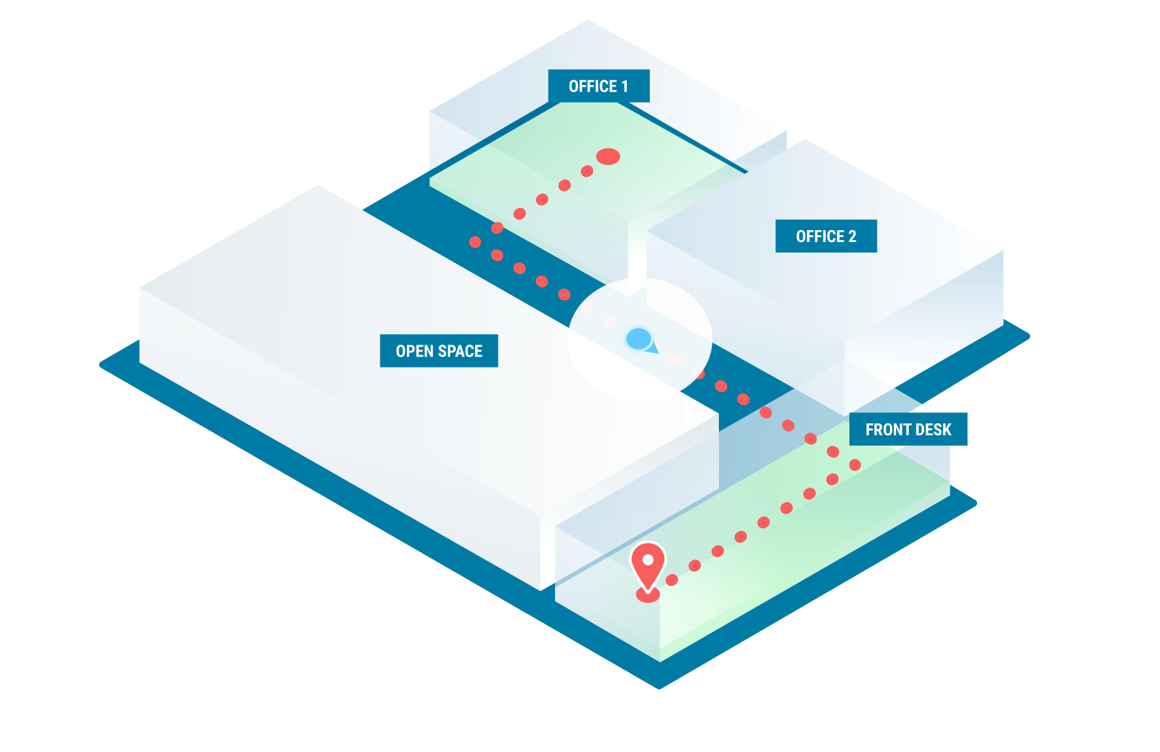
NAO® Maps allows indoor maps to be created from standard cartographic and graphic formats such as DWG, DXF, SVG, PNG or GeoJSON. Once imported, maps can be structured by floor and enriched with operational elements including zones, points of interest, geofences, routes and BLE infrastructure components.
These elements are not purely visual. They are directly used by the NAO® Suite to calculate positions, trigger alerts and generate analytics, making the map a functional component of the location system rather than a static background.

integration with the NAO Suite
NAO® Maps is natively integrated with NAO® Track, NAO® Viewer, NAO® Flow and the NAO® Cloud or Server. Any update made to the cartography—such as modifying zones, adding geofences or updating infrastructure elements—is automatically synchronized with the location engines and supervision interfaces.
This real-time synchronization guarantees consistency between what is displayed on maps and how locations are computed and exploited across the platform.
Multi-floor, multi-site & coordinate accuracy
Designed for complex infrastructures, NAO® Maps supports multi-floor buildings and multi-site deployments, while maintaining precise geographic coordinates. This ensures that assets, people and events are always positioned on the correct floor and in the correct building, even in large or distributed environments.
Centralized map management allows operators to maintain a consolidated view of their infrastructure, while preserving local accuracy and operational detail.
APIs, SDKs & digital ecosystem integration
Through REST APIs, real-time interfaces and SDKs, NAO® Maps can be embedded into third-party applications such as mobile wayfinding solutions, operational platforms, security systems or digital twins. This interoperability allows indoor cartographic data to be reused across the organization’s digital ecosystem, avoiding duplication and inconsistencies.
NAO® Maps therefore acts as a shared cartographic reference that connects indoor location data to business and operational systems.
Security, hosting & governance
NAO® Maps can be deployed either on NAO® Cloud or NAO® Server, depending on security and governance requirements. Access to cartographic and location data is protected through authenticated APIs and encrypted communications, ensuring confidentiality and reliability.
This deployment flexibility makes NAO® Maps suitable for both open environments and regulated or sensitive contexts where data control is essential.

A reliable foundation for indoor location services
By providing a single, consistent and operational view of indoor spaces, NAO® Maps transforms cartography into a core component of indoor location services. It enables organizations to deploy reliable positioning use cases, maintain operational consistency across sites and fully exploit indoor location data with confidence.